
There are two different types of trails that display on maps in Topo Maps+:
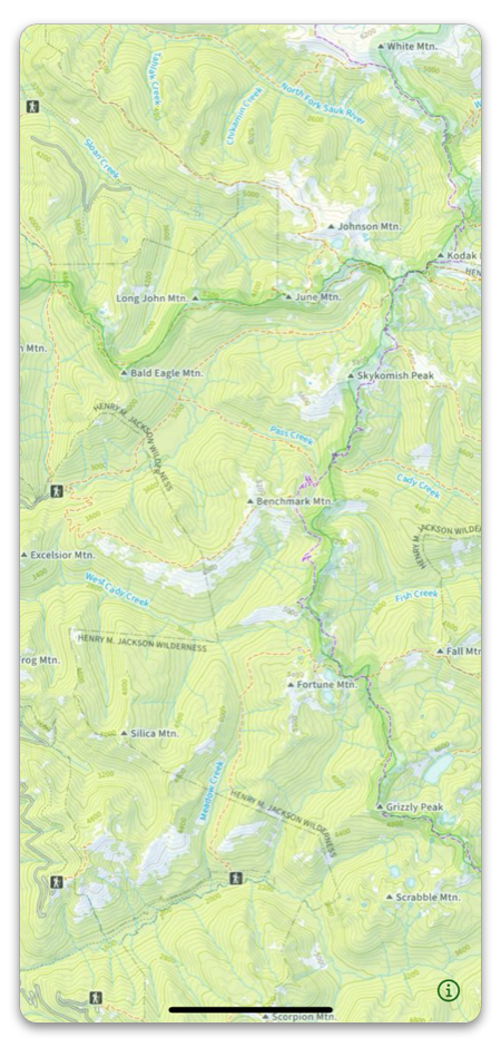
Visual Trails: There are many trails that are displayed on maps as a trail, but is not selectable as a trail. This is because they embedded in the actual map image that we license, not added on as an overlay. They can be used as a visible guide, but do not support the On-Trail tools. Note: If there is a trail that only has the visible option, you can trace it freehand with the Route tool and save it as your own route.
If you are using Visual Trails on a map, click here to learn how to access the legend.
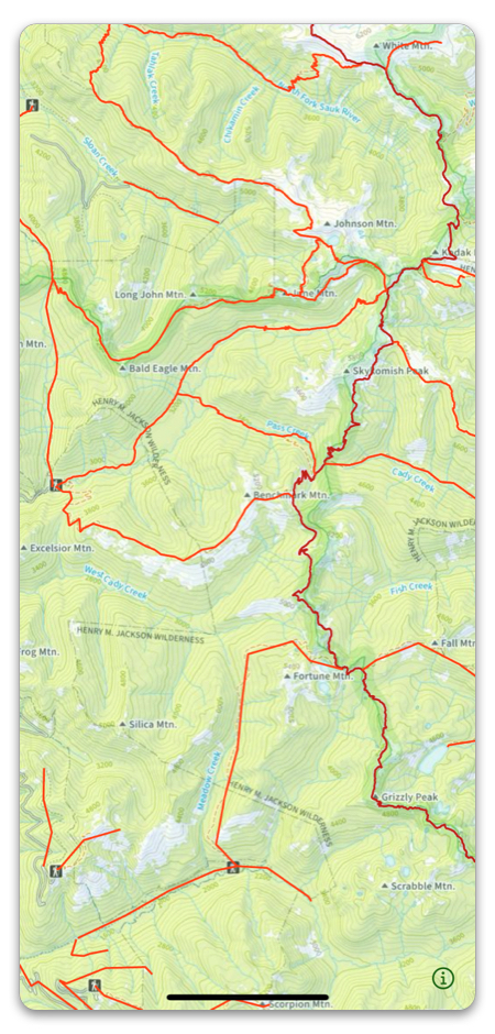
Selectable Trails: Trails that show up on the map as selectable (they are colored green in the Natural Atlas) can be saved, downloaded, and support the On-Trail tools. Think of them as a pre-drawn Route. Selectable trails come from trail overlays (Open Street Map Trails or US Forest Service)
For a visual comparison, take a look at the following images:
Activating Trail Overlays:
There are two trail overlays offered in Topo Maps+:
Open Street Map Trails (Worldwide)
and
US Forest Service Trails (US only)
The OSM trail overlay is active by default, but you can toggle it on and off from the overlay dashboard:
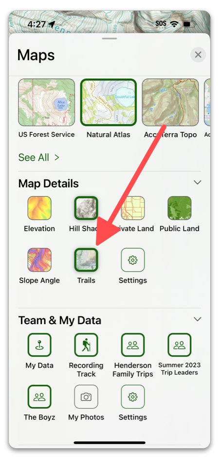
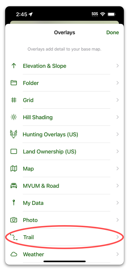
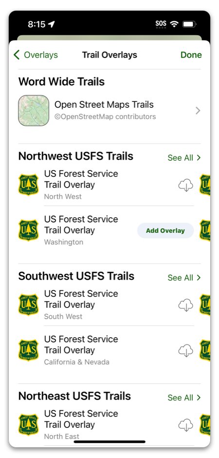
To add a USFS trail overlay, tap “Settings”, then scroll down to “Add More Overlays”:
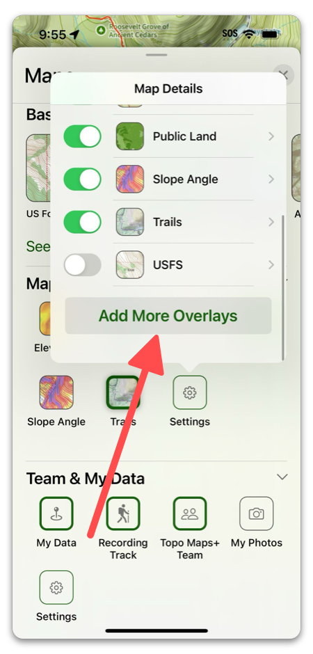
Tap on “Trail”, and the trail options will display. If you have one of them downloaded, the “Add Overlay” button will display.
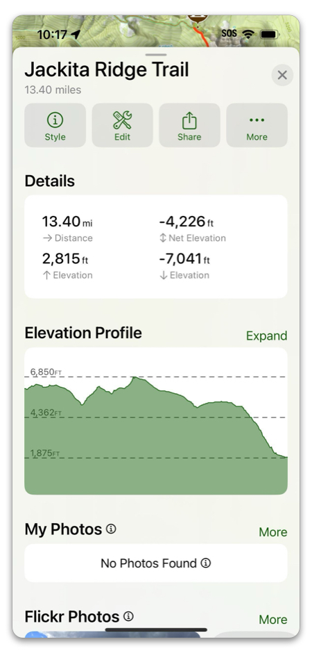
When you tap on a Selectable Trail, you can view Properties, the Elevation Profile, make notes, view segments of the trail, and even attach photos:
Manipulating Trails:
One of the benefits of “selectable” trails is that you can turn them into your own Routes and customize them.
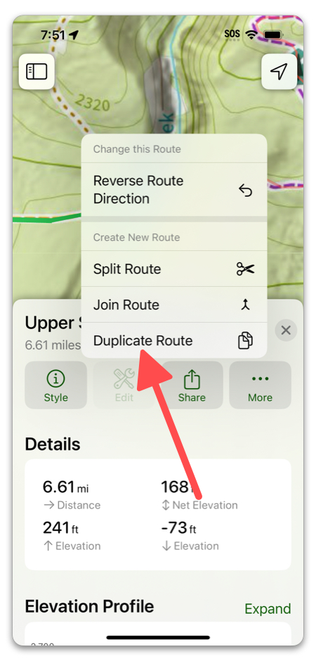
- Duplicate Trails: Tap on a trail and tap Edit -> Duplicate Route. This will give you your own copy of the trail to manipulate. You’ll be able to add to it, change it, etc.
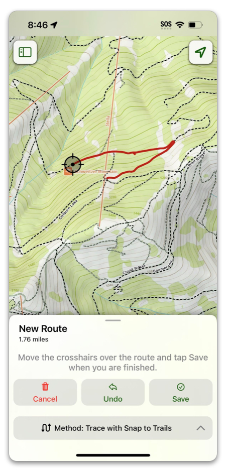
2. Snap to Trails route drawing: Another benefit to selectable trails is that you can use them while drawing routes with the “Snap to Trails” tool. This traces part or all of a trail so you don’t have to freehand it.