
To share, export, import or print on Mac click “File” up in the toolbar. There is also an additional print icon on the right hand side, and a “Share Links” button in the main menu. (See also the keyboard shortcuts on the dropdown menu)
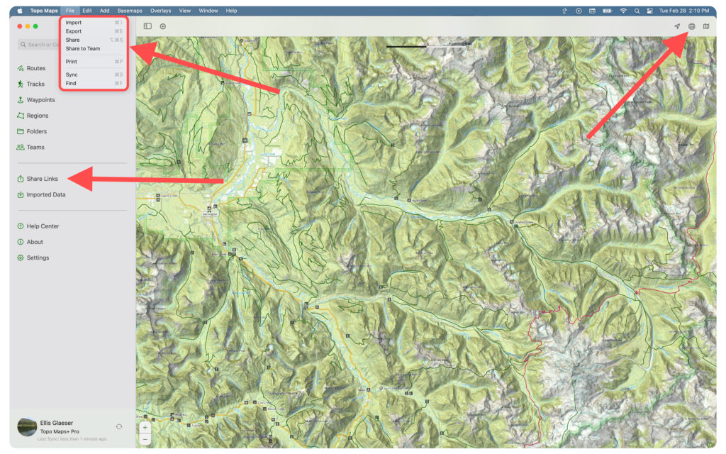
Sharing or Exporting will pull up this menu:
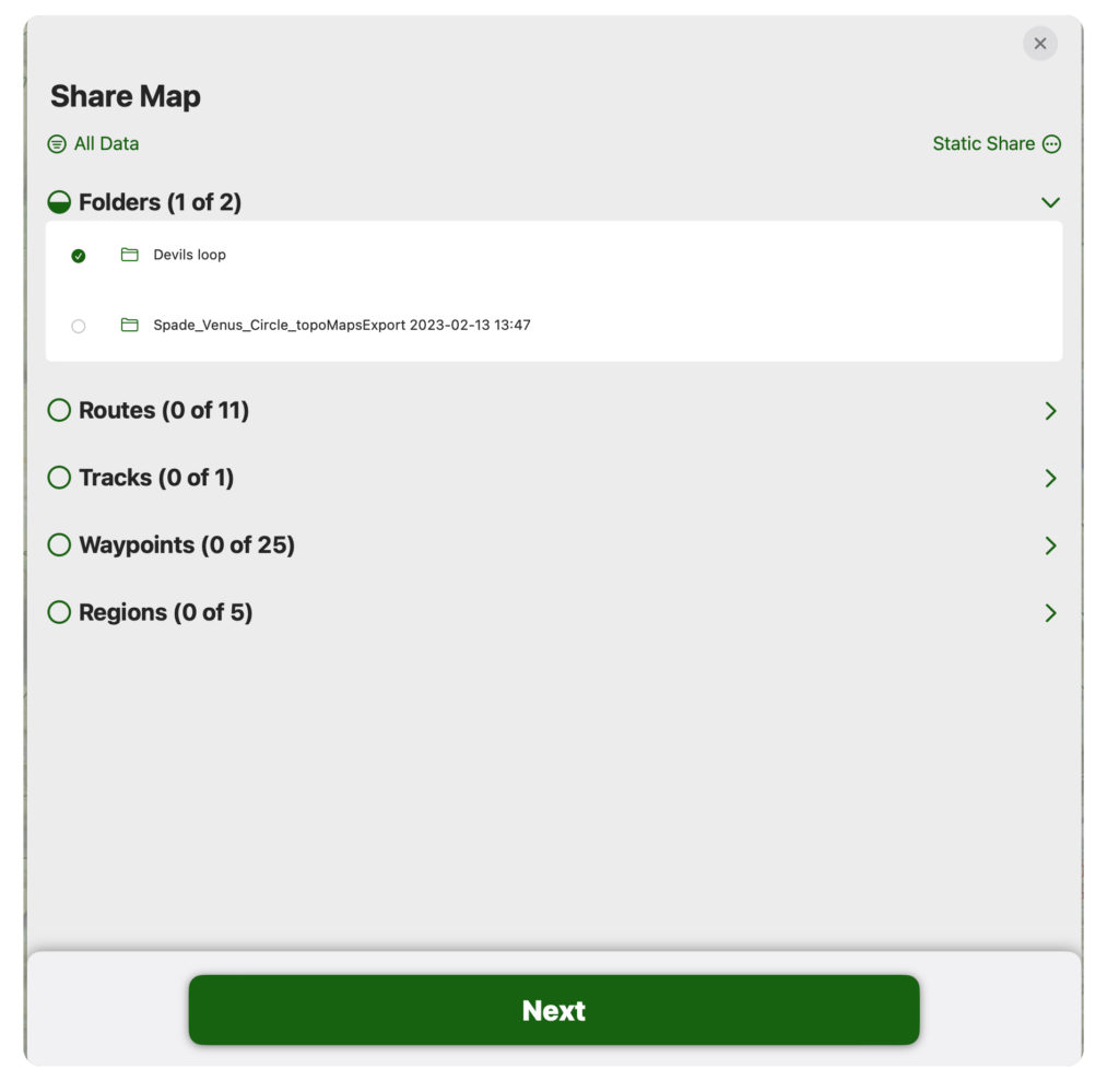
Select the data you want to share (most common are folders, as you can share organized trip data this way).
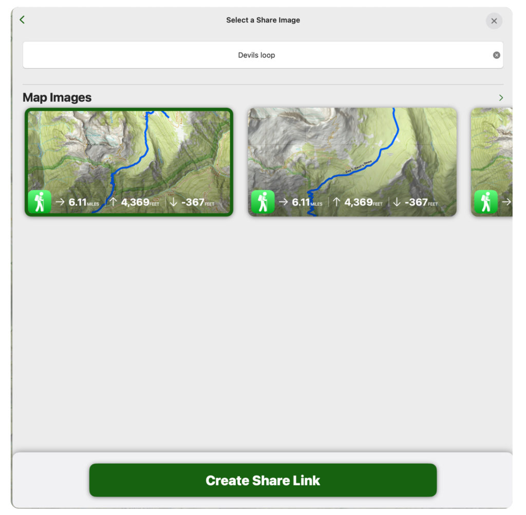
When sharing, you will need to select an image to display as the thumbnail.
Printing:
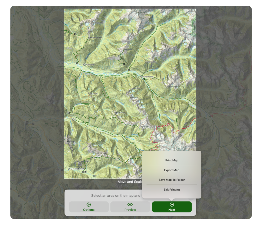
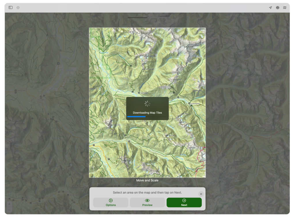
Navigate to the area you want printed and click on the print icon.
Click “Options” to select what you want to show on the map, what file type you want, and orientation settings.
“Preview” will generate a print preview that is downloaded automatically.
“Next” allows you to choose between printing, exporting, saving to a folder, and exiting.
Note: There is no download button for the Mac app since it is not typically used offline, but there is a hack you can do. Click on the Preview button to generate a print preview. It is then downloaded automatically. You should be able to view what is in that preview when you go offline.
Additionally, when you view an area on the Mac, it is cached and never deleted. So if you zoom and pan the map over an area everything that you see in the app will be available offline. You can try this in Topo Maps+ on your Mac by viewing a map, quitting Topo Maps+, then turn off WIFI, open Topo Maps+ and you will still be able to see the maps you were viewing.