
I have never been lost but I was bewildered once for three days.” – American frontiersman, Daniel Boone.
Seeing the blue dot on the map can be pretty reassuring when you are deep in the backcountry. When you get confused or lost, having a digital map to locate yourself on is very helpful.
But, while Topo Maps+ is a great navigational app, technology always has the potential to fail.
You never know when your device may run out of battery, get dropped into a creek, etc.
Before going into the backcountry, you need to take on a navigational mindset, preparing yourself for the worst.
Here are some practical ways to do that:

Carry a printed map (learn how to print in Topo Maps+ here). Having a paper map is a great idea, since it doesn’t have the drawbacks an electronic device has: limited battery life, requires a touch screen, and generally fragile. If you want a super durable map, REI has some great weatherproof paper.
Carry a compass and learn how to use it. Paper maps are only helpful if you know how to use them, and a big part of that is using a compass in correlation with a map. REI also has a great educational video on that.
Observation. This starts during the planning phase of each trip. While mapping out your routes, it’s important to get an idea of what the terrain will be like and what you can expect to see.
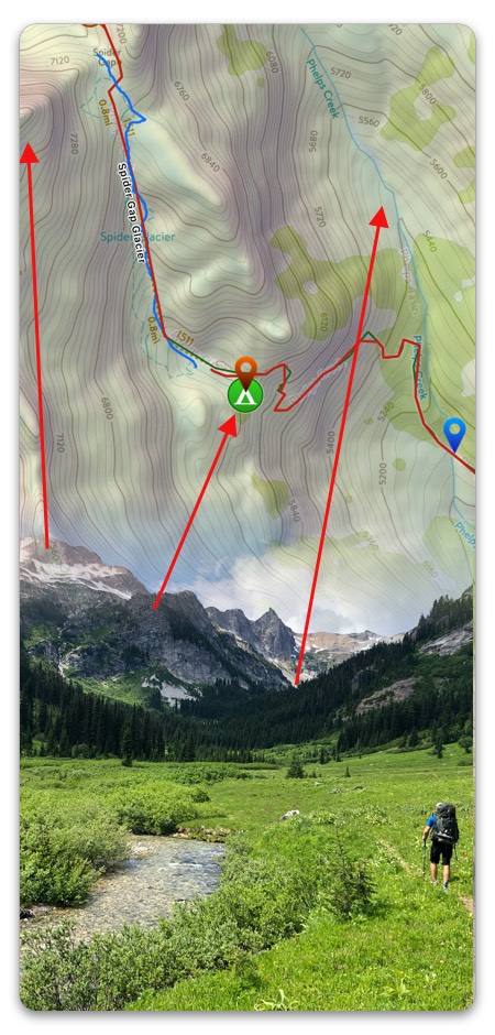
For example:
- For the first two miles we will be hiking north on the east side of a ridge. I expect that the Ridgeline will be on my left side and that creeks will be flowing east.
- We will cross a creek at 1 mile in and it is at an elevation of 6,200 ft.
- After the first 2 miles we will gradually turn west and climb a lot of switchbacks to a saddle at 7,600 ft.
While you do not need to memorize the entire trip before going out, you should have a general idea of what to expect.
On the trail, you should be asking questions like:
- What have I seen?
- What am I currently seeing?
- What do I expect to see?
Taking notes on a printed map or in Topo Maps+ can be helpful when observing things and for keeping you on track. When you reach points of interest along the hike, pull out the map and look at the information for the next segment so you’re confident how to get to the next landmark.
If what you see on the trail does not line up with what you have seen, stop and figure out where you are and make sure you are still on the right trail.
It may be that your expectations weren’t accurate, or you may have took a wrong turn.
So remember:
- Plan ahead.
- Don’t rely on tech.
- Observe your surroundings.