
At Topo Maps+ we offer several categories of tools to help you execute safe backcountry trips:
Maps, Planning Tools, and On-Trail Tools.
Maps:
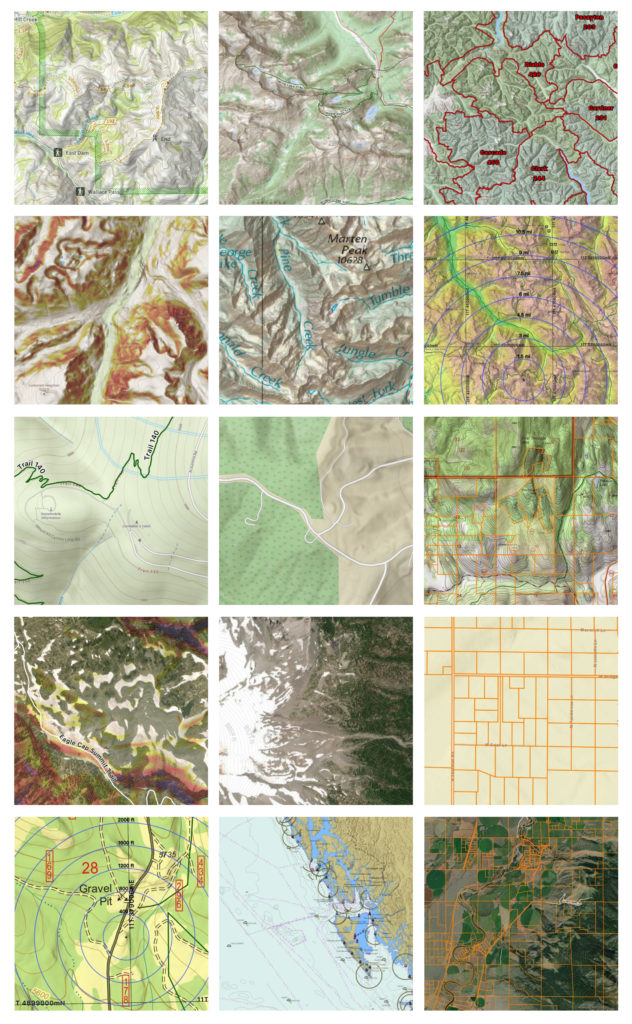
There are a variety of map options in Topo Maps+. With our base map selection and all our overlays, there are 600+ combinations! Tap here for a list of maps we provide, and here to learn more about how we set up maps for different activities.
Planning & Taking Maps Offline:
Planning the trip is perhaps the most important step: deciding on a route, looking ahead for possible issues or dangers, being prepared for bad weather, no service, etc.
Topo Maps+ has a variety of planning tools including creating your own route, using existing trails, dropping waypoints, creating regions and much more, to make sure you make it safely to your destination!
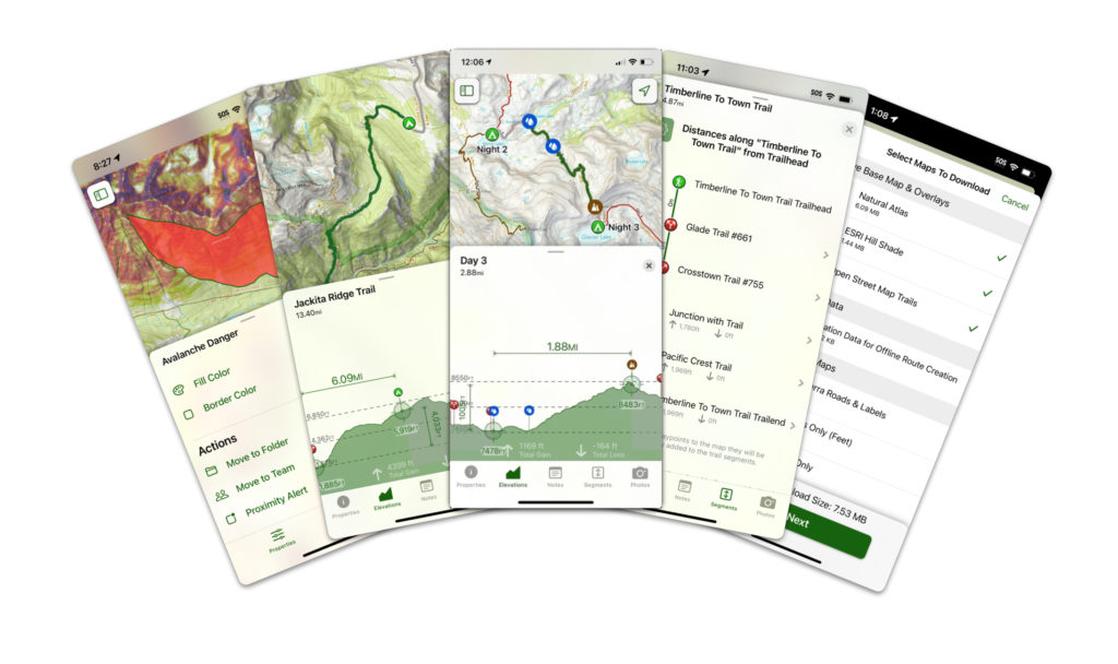
Going offline is especially important for backcountry trips. With Topo Maps+, you can:
On the Trail:
Topo Maps+ is designed for offline use while deep in the backcountry. As long as you download your maps before you go, you can access all of these features without connection to cell or internet!
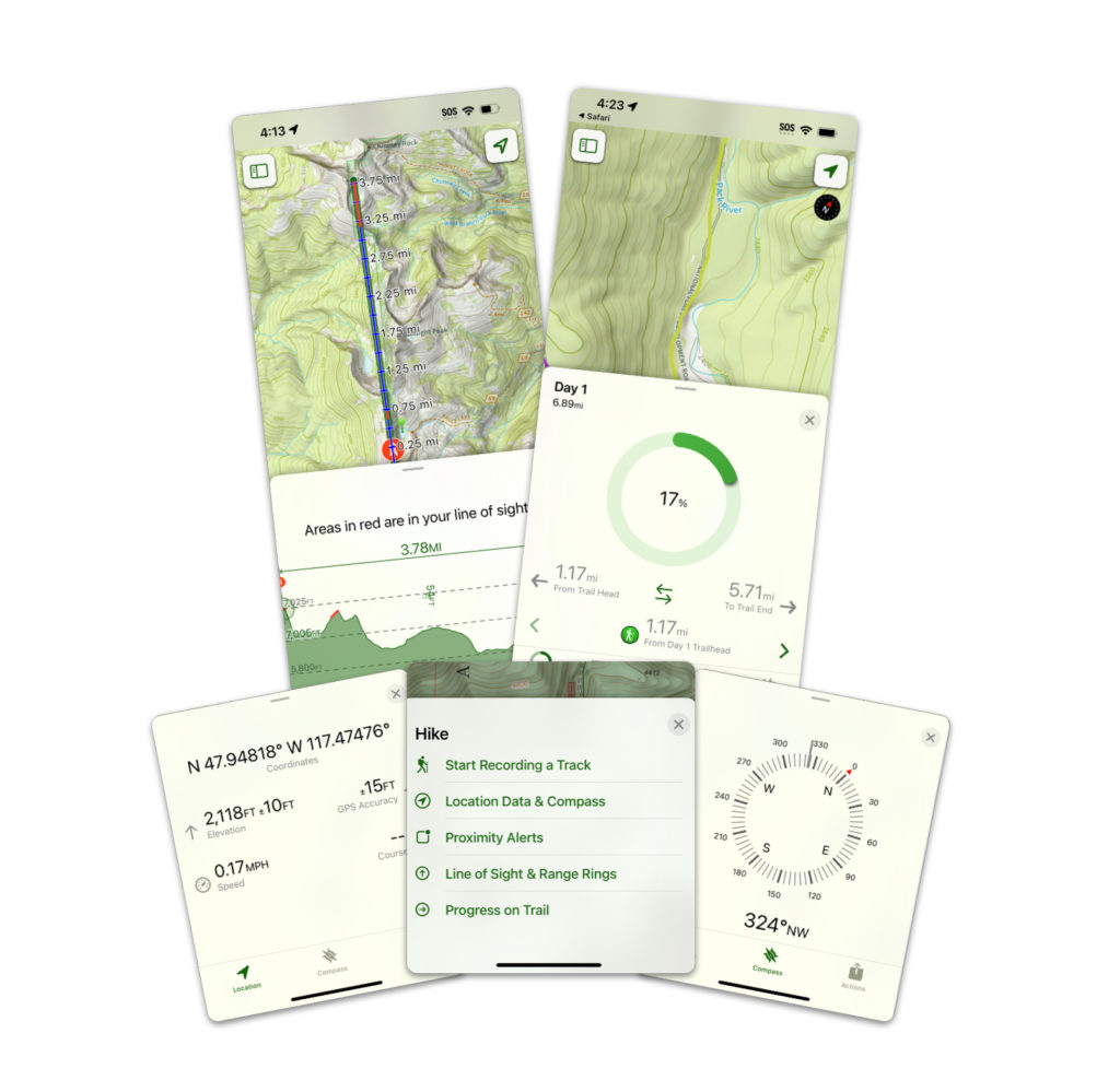
On-Trail features include: