
There are many times that I check my map not for direction, but because my legs are aching and I just want to know how much farther to go to camp before I can pull out my chair, put my legs up, and enjoy some dark chocolate with a nice hot cup of tea.
This is what I USED to do.
• I would start recording a track at the start of the hike.
• Then I would check the total distance traveled and subtract that from what I knew was total distance to the end of the hike.
BUT….. 😬
This has a HUGE problem.
By the end of the first day, my battery would be dead. ☠ ☠
Recording a track requires constant GPS usage and powering GPS take a lot of battery!
So, I figured there must be a better way.
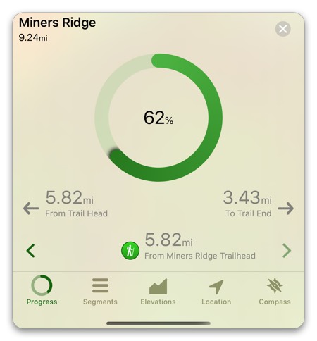
This is where the idea for Progress on Trail came from. Progress on trial takes you current location and analyzes the trail you are on and it will let you know how far you have come AND it will tell you how far you have left to go. It does this without constantly using GPS. Now when I go backpacking, I can have one full battery charge last me 3-4 days! 🤯
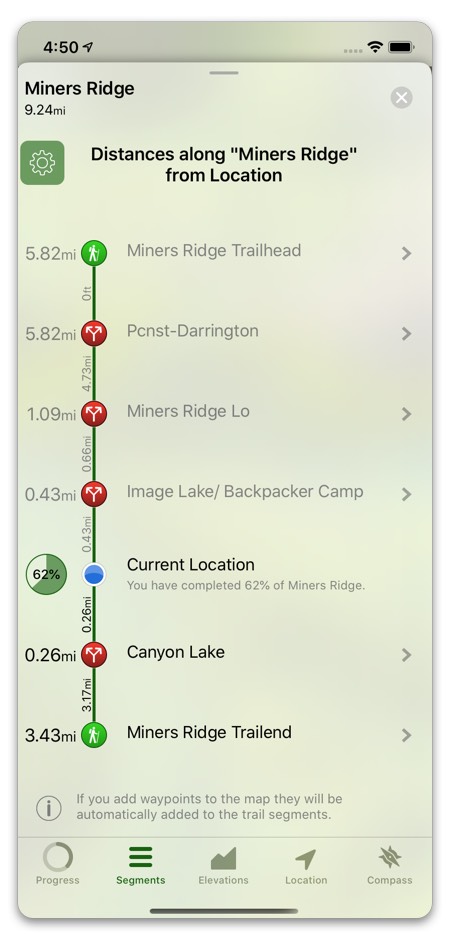
Not only that, Progress on Trail will show you the distance to every waypoint on your trail! Just select the Segments tab. If your legs are really aching and you just need to stop for the night, you can see the distance to all of the waypoints you added to the map. (You are planning ahead for your trips, right? 😉 )
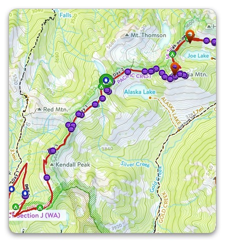
If you do like leaving a “breadcrumb” trail to show where you’ve been on the map, another way to do it with Topo Maps+ subscription is simply taking a picture every 5-15 minutes. When the photo overlay is turned on it’ll leave a nice little visual trail with the photo icons. Plus! You’ll have a visual documentary of your hike.
If you haven’t seen the photo overlay before it’s pretty cool. It’ll even show the general direction you were facing when the picture was taken too!
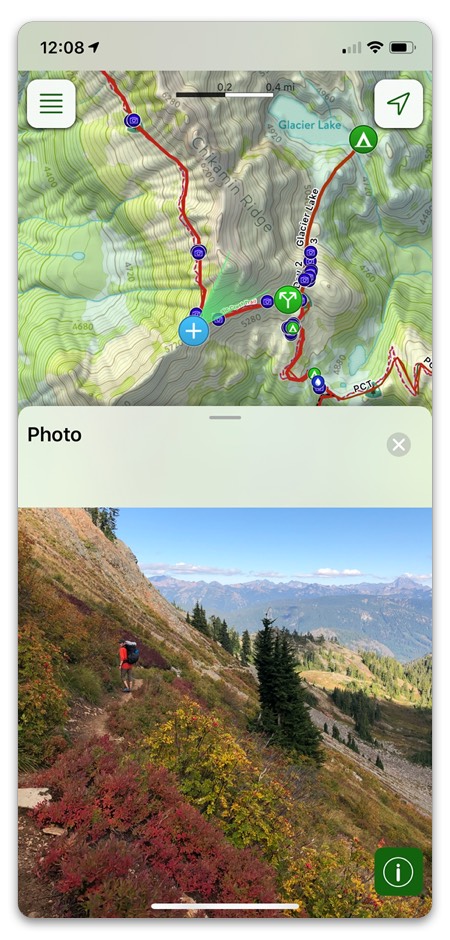
Just make sure you have location services turned on for your camera and the photos will show up automatically on the map as you take each picture.