3D maps bring your routes to life by showing the terrain in three dimensions. Tilt and rotate the view to clearly see climbs, descents, valleys, and ridges, making it easier to plan and navigate with confidence. With 3D, you get a more realistic perspective of the landscape than a flat map can provide. Instead of building a general-purpose 3D map that only partly fits outdoor use, we designed a 3D map specifically for planning adventures, with a “look around” interface, so that you can see where you are looking at, along with showing you where you are on the map.
Note: 3D maps include ALL of your map data.
Exploring Maps in 3D:
- Tap Maps, which is located on the bottom of your screen.
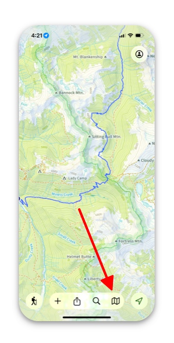
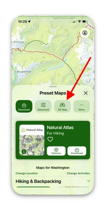
2. Select the 3D Map button.
Note: It does not matter whether you are in Advanced Maps or Preset Maps, both will get you to the same 3D map.
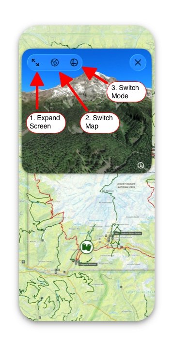
3. The following picture will appear on your screen. The binoculars icon on the map shows you where you are and what direction you are facing. You can move them to your desired position by tapping and moving it.
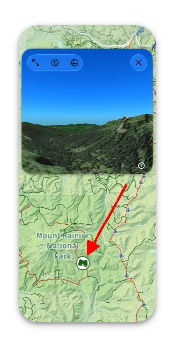
4. If you want to pull up a 3D map of an exact location, just hold down on the map where you want to view it, then tap 3D Map in the card that pops up.
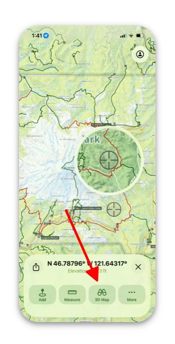
5. On your 3D Map screen there are 3 buttons in the top left corner:
- Expand Screen: This lets you experience 3D map full screen.
- Switch Map: Tapping this button switches the map between satellite and topographic imagery.
- Switch Mode: Tapping this button will switch you between either being able to turn right left, up, down, to being able to swipe and go forward, backward, etc.
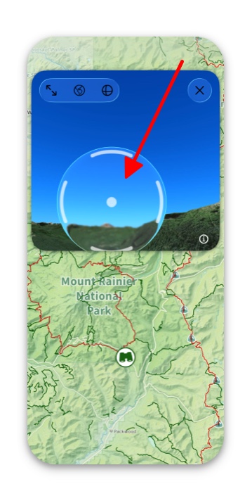
6. “Fly Mode”: To do this and “fly” around in the 3D maps, simply tap and hold. A glass-looking circle will appear, and with it, you can move in whatever direction you would like.